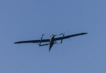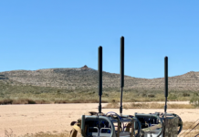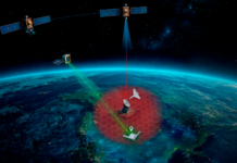



VNS01 Visual Navigation System – UAV Navigation–Grupo Oesía has announced major software enhancements to its VNS01 Visual Navigation System, introducing advanced Terrain Referenced Navigation (TRN) and Satellite Map Matching algorithms to improve navigation accuracy during operations in GNSS-denied environments and over previously unflown routes. Available through a software update, these enhancements further strengthen the company’s position in resilient navigation technologies for autonomous aerial platforms.
Already deployed as a resilient navigation solution for GNSS-denied operations, the VNS01 now improves its navigation performance through the incorporation of Terrain Referenced Navigation (TRN) and Satellite Map Matching. These new technologies provide additional sources of absolute positioning in previously unexplored terrain, helping maintain accurate navigation during extended GNSS outages.
Satellite Map Matching uses preloaded satellite imagery as a navigation reference. By correlating onboard camera images with geographical features such as roads, rivers and coastlines, the system generates absolute position corrections that compensate for inertial drift and improve navigation accuracy.
To complement this capability, Terrain Referenced Navigation provides an additional source of positioning by correlating altitude measurements collected in flight with preloaded Digital Elevation Models (DEMs). This allows the system to estimate the aircraft’s most likely position and continue generating navigation corrections even when visual references are limited or unavailable.
Unlike conventional dead-reckoning navigation systems, where positioning errors increase progressively as distance is flown, the combined use of Visual Odometry, Satellite Map Matching and TRN enables the VNS01 to keep navigation error bounded during extended GNSS outages. Under favorable operational conditions,the system that has demonstrated positioning errors can be constrained to approximately 30 meters, regardless of the distance travelled.
The new algorithms have been developed to support mission continuity in contested and GNSS-degraded environments, helping UAS manufacturers and operators maintain mission effectiveness in the presence of jamming, spoofing and other threats affecting satellite navigation systems.
As part of UAV Navigation–Grupo Oesía’s ongoing commitment to innovation in resilient navigation, these new capabilities further expand the company’s multi-sensor approach to assured autonomy, combining complementary navigation technologies to deliver precise positioning and mission continuity when GNSS signals are unavailable or compromised.To learn more about the VNS01 Visual Navigation System and UAV Navigation–Grupo Oesía’s resilient navigation solutions for GNSS-denied operations, visit the UAV Navigation–Grupo Oesía website. Visitors can also meet the team at upcoming events, including UNVEX in Spain and MSPO in Poland, where the company will present its latest innovations in assured autonomy, resilient positioning and mission continuity.